Category Archives: Rides

Motorcycle rides both short and long

Bike Routes in Oahu

Alice and I have rented a place in Honolulu for about 7 weeks before we move into our new place in Ventura.    So we are living like residents for a bit.   One of the first thing I did was buy a used mountain bike to do some exploring.   Got a decent hard-tail for $200 and it is holding up pretty well.

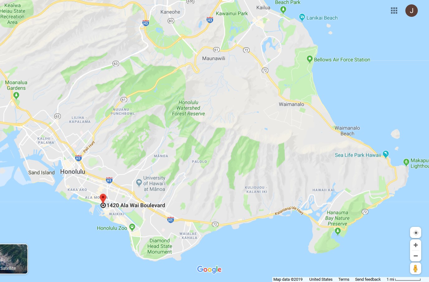
Home base is here in Waikiki

Area of Mountain Bike Operations

Here is what I’ve found so far using a combination of guides, guesses, and occasional trespassing.   Note: Almost all is paved or roughly paved so far.

Makapu ‘ing

This has been my go-to route for getting some exercise and nice views.   Water up before leaving Waikiki.  You can get some food/water at Hawaii Kai but East of there you are on your own.   No towns, haven’t found a working water tap.

Take swim gear and snorkel.  Plenty of spots to jump in the water to cool off.

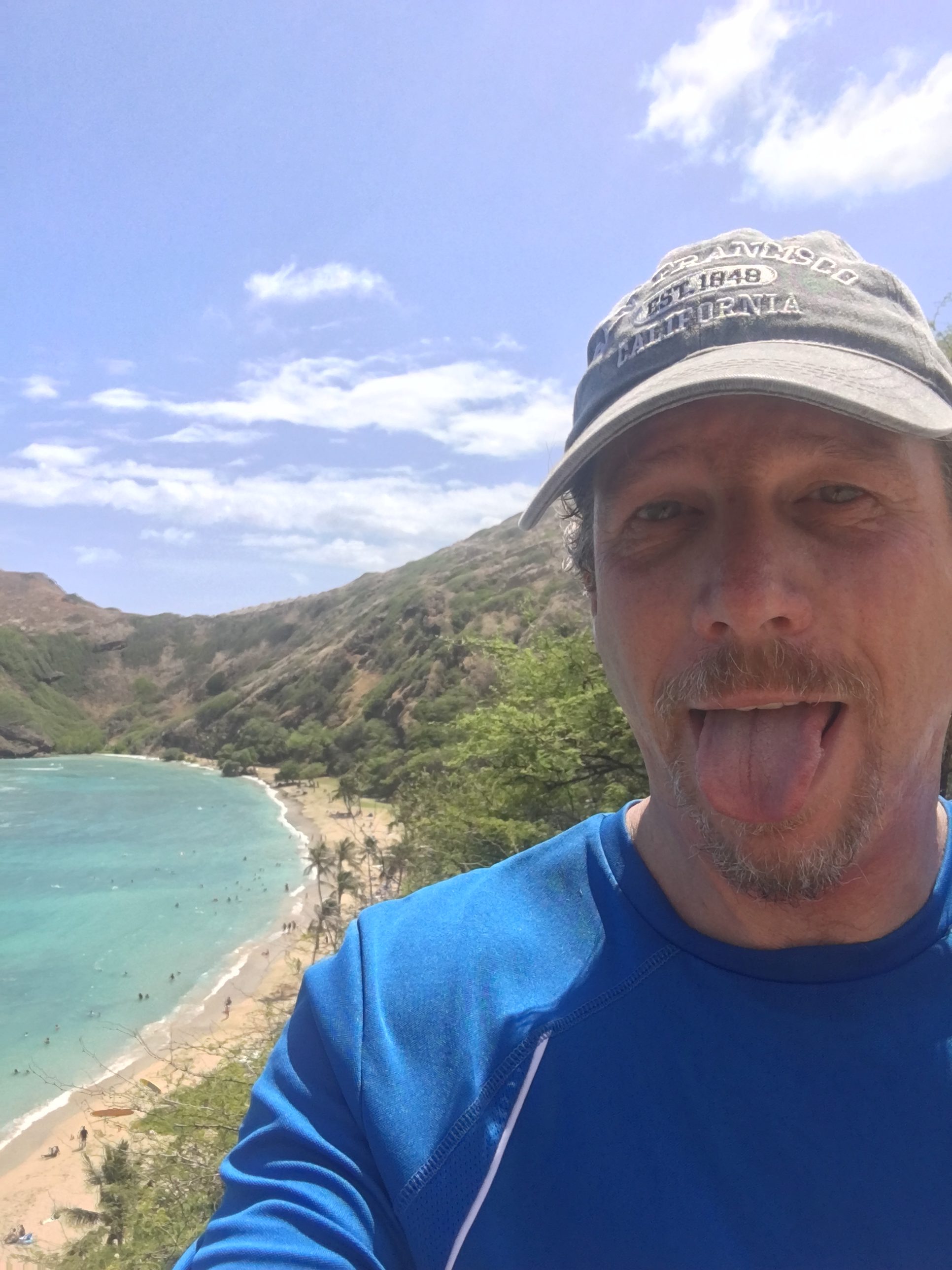
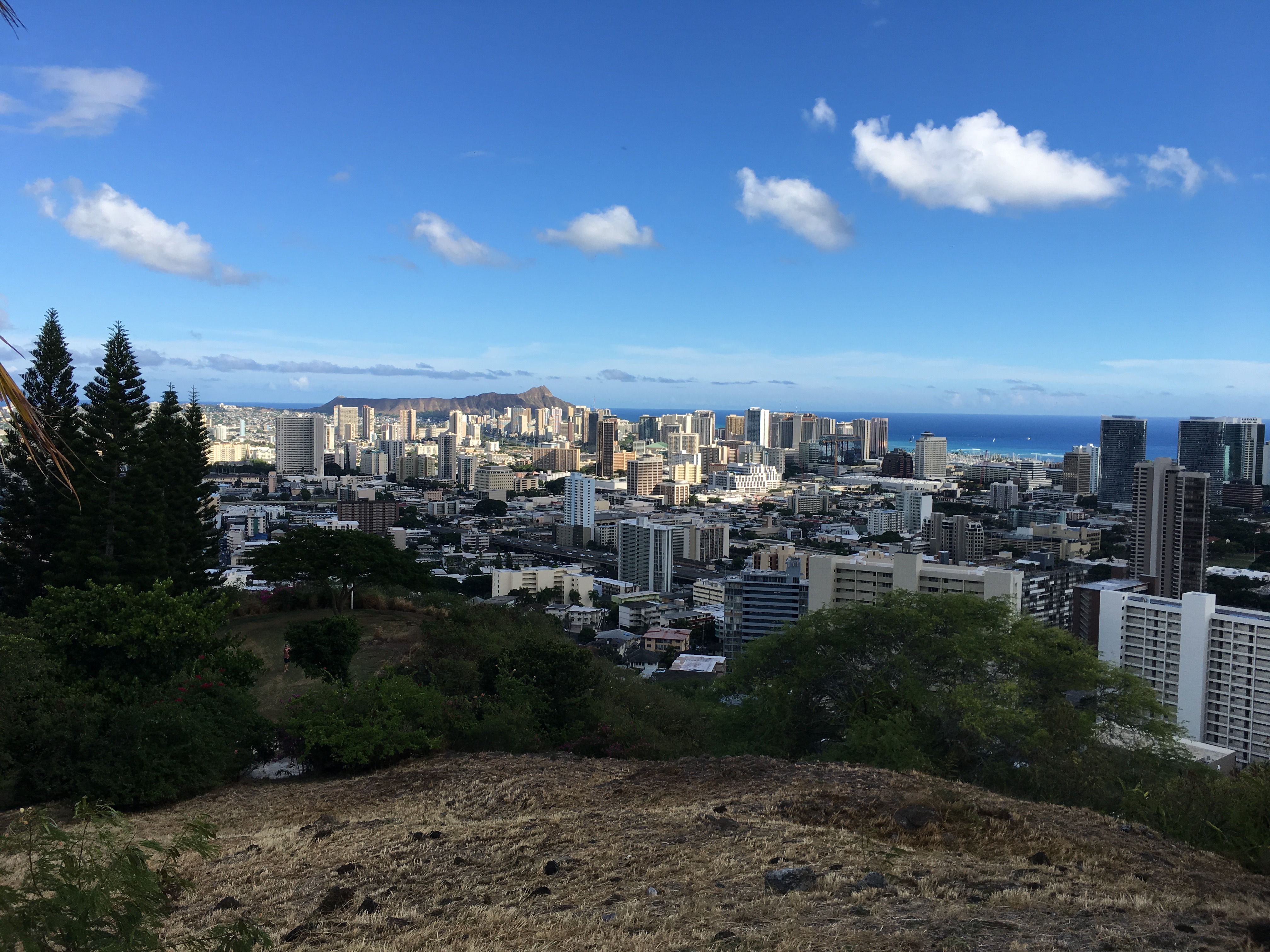
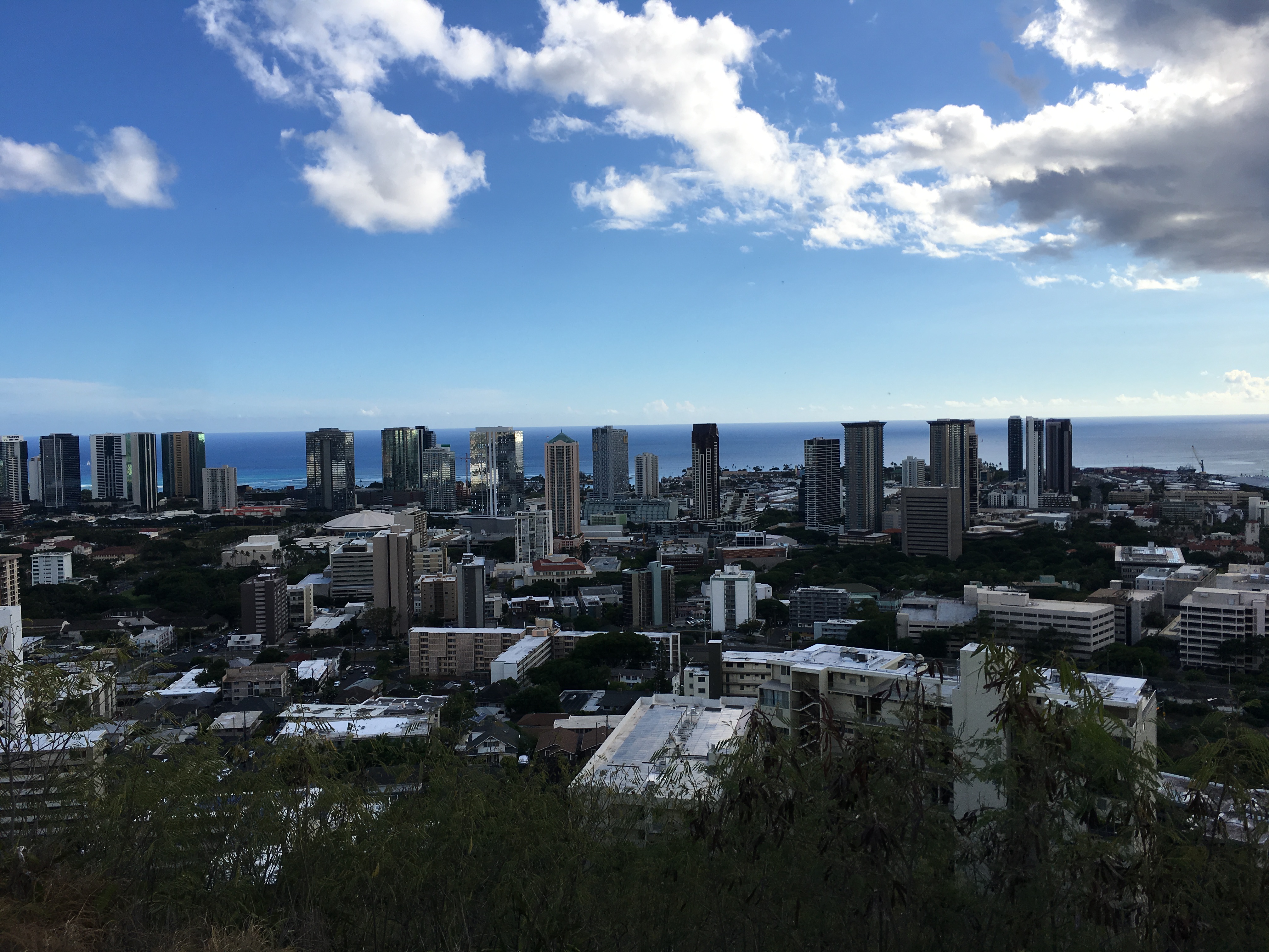
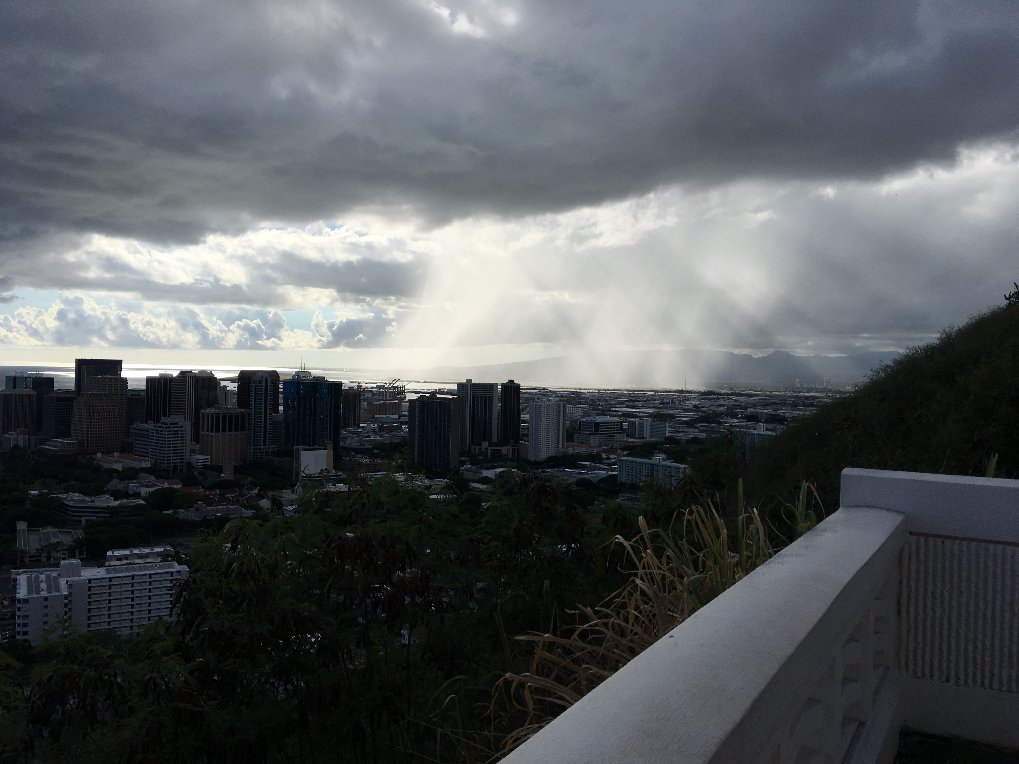
Here are a few pics from recent outings.
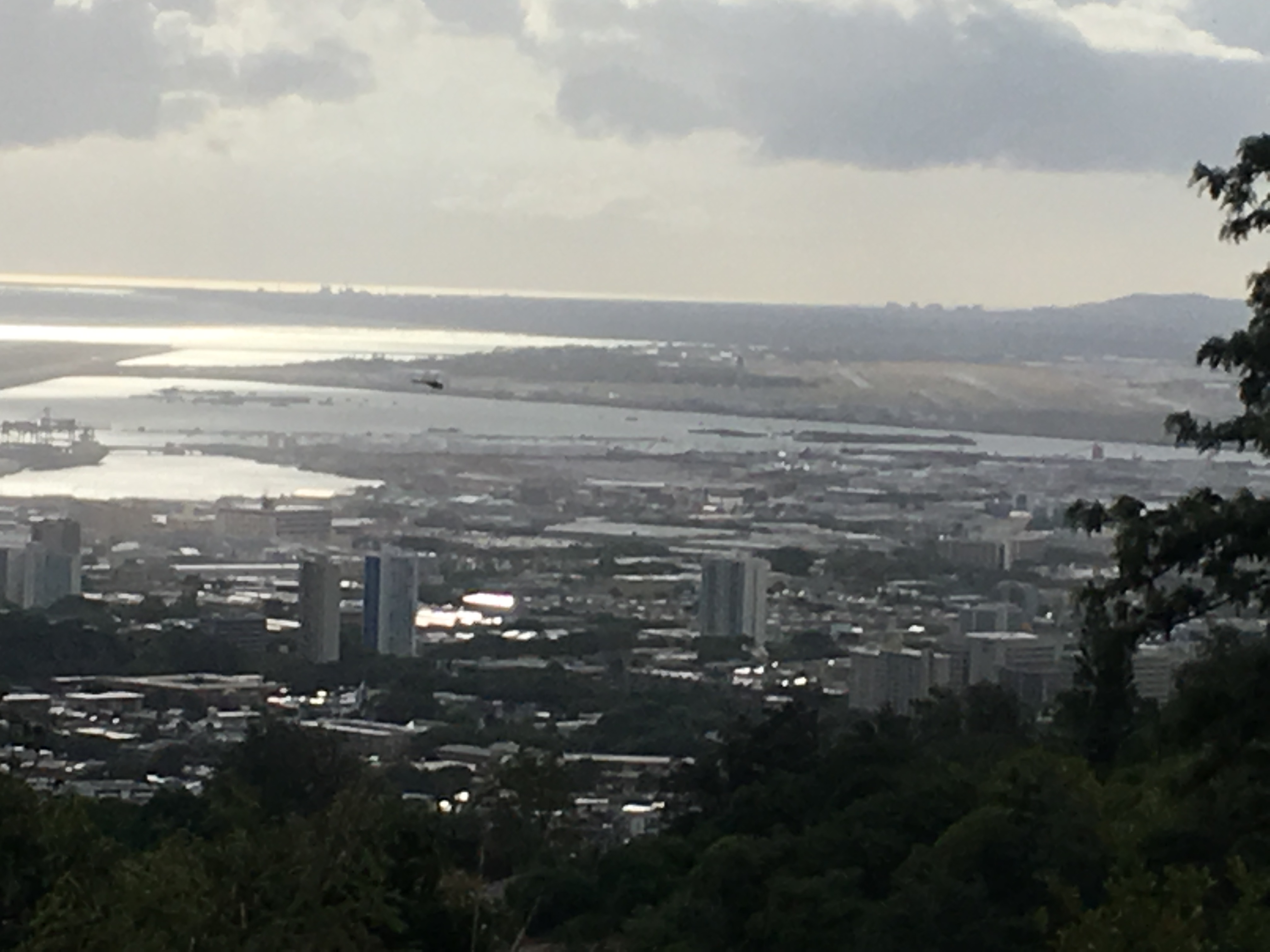
East of Hanauma
Climb to Makapu’u lighthouse. There’s some double track dirt goodness down there
Panorama from above Makapu’u Lighthouse

Punchbowl

This was not one of my best route planning outcomes.   I basically just hooked up with Alice for some food and then heard about the Punchbowl and figured the road called “Punchbowl” would get me there.   I recommend finding a better loop.

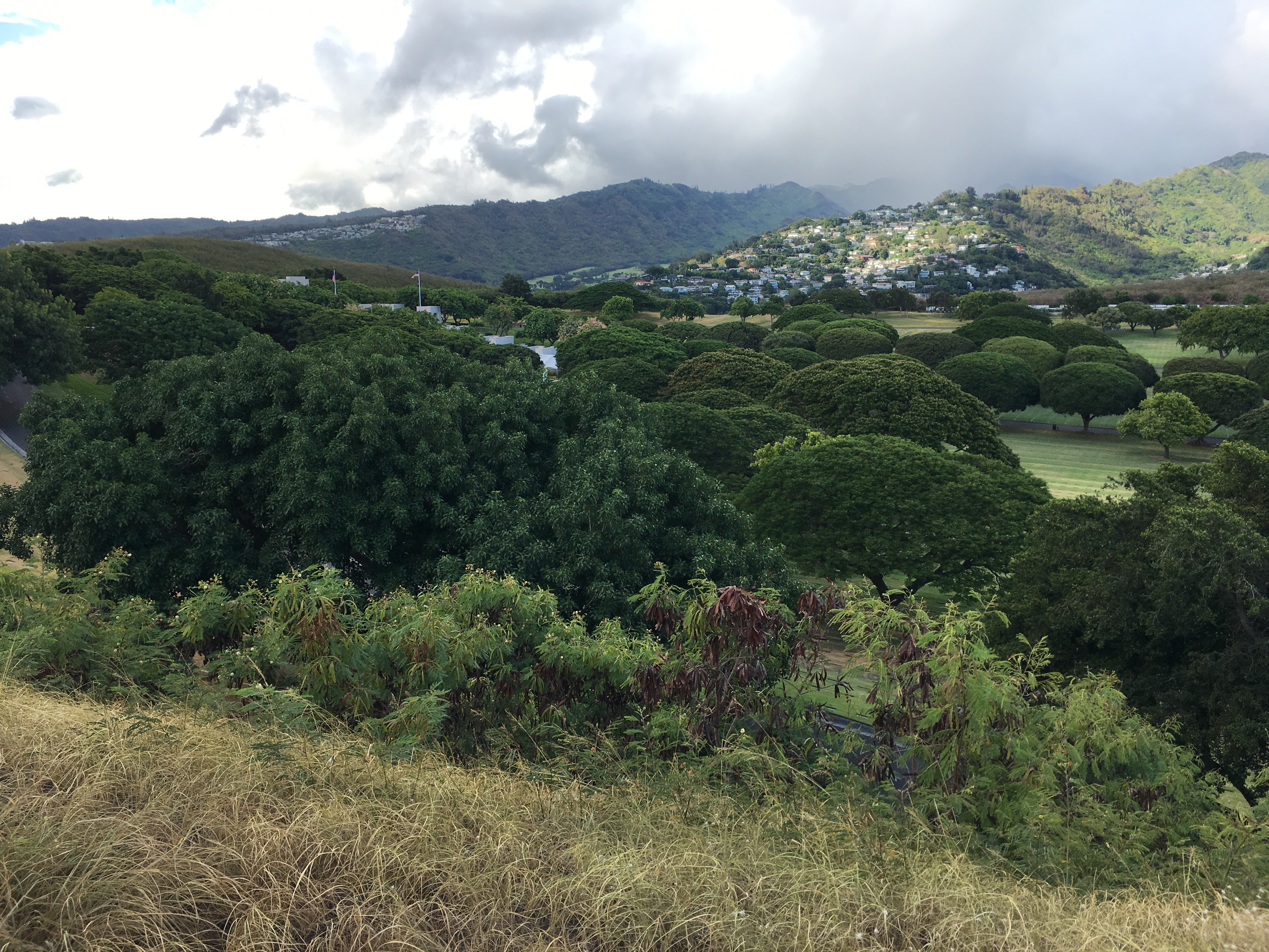
When you get to the top you will find a huge military cemetery and memorial to (mostly) vets from WW2, Korea, and Vietnam.   I find it interesting that so many of the Japanese-American vets have fresh flowers on their markers.   Anyway, here is the view that awaits.

Money !
Still Paying
Toward Pearl Harbor
The Cemetery, Super Peaceful

Failing to Pearl Harbor

Not everything works out.   Here is an example of where not to go.

Sucks

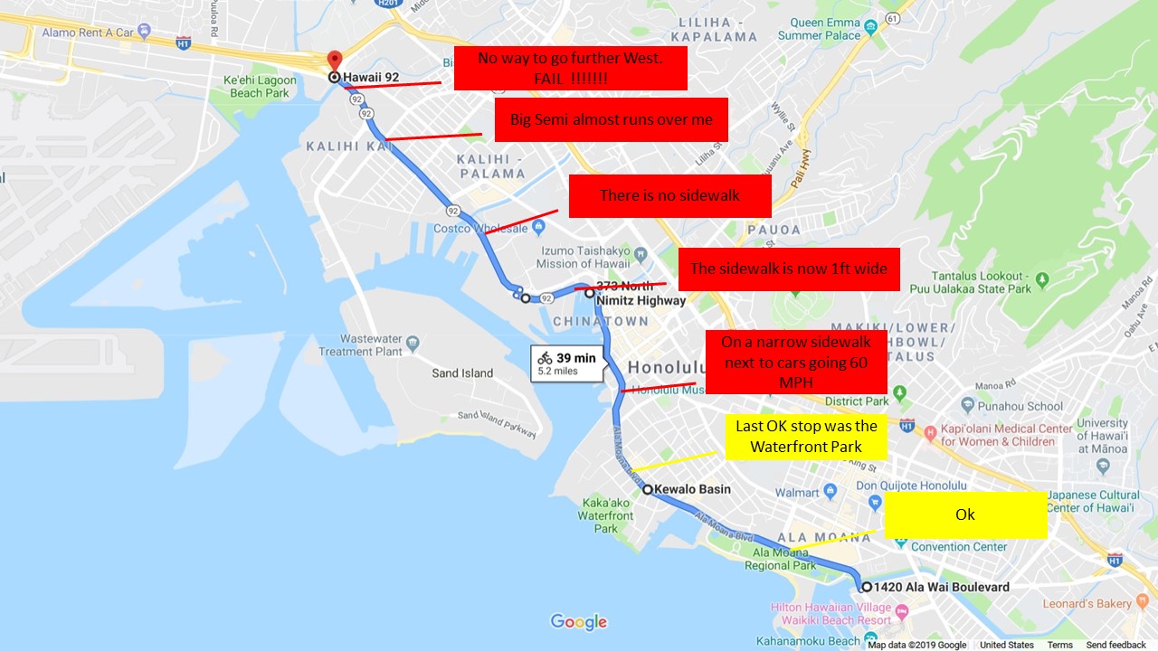
There are no pictures.

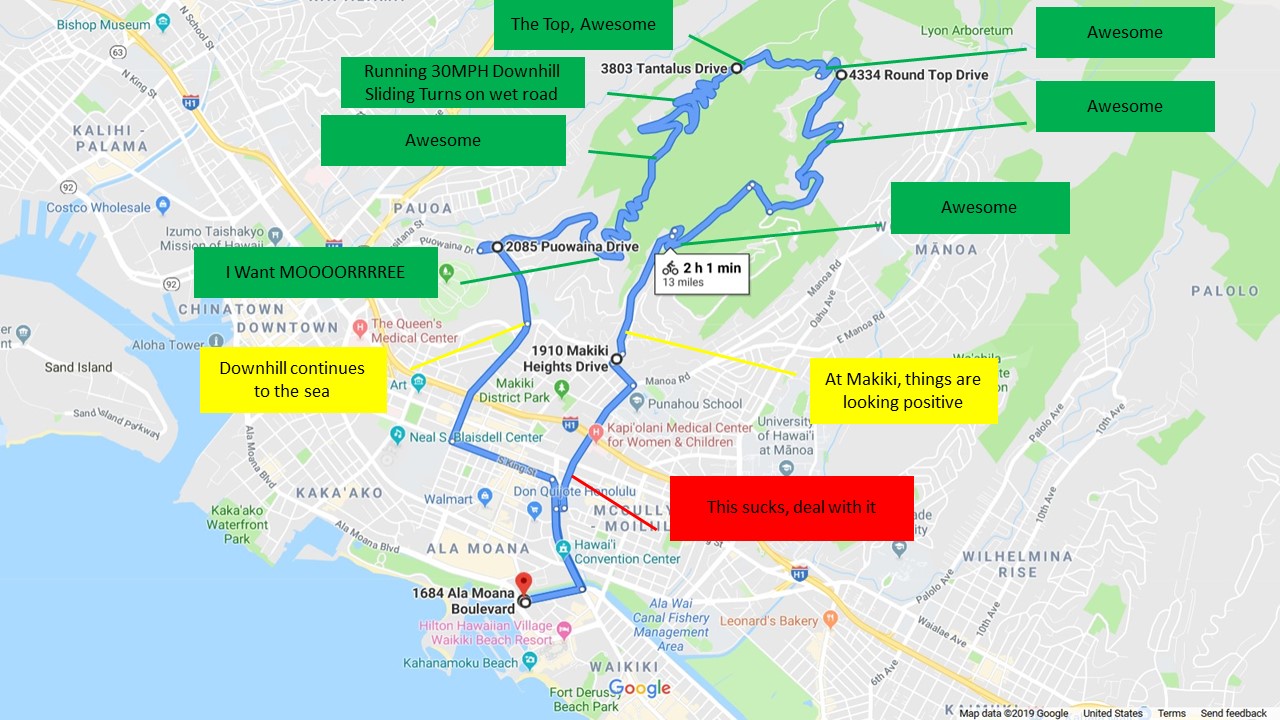
Winning with Tantalus

I’ve included my second route through Tantalus which, according to Google, is only 13 miles.   But these are some hard miles.   This is a 1500 foot climb up into a rainforest and yes, it is raining.   It has that feel like it is wet all the time.    At the top the temp was at least 10 degrees cooler.   Rode through the rain on the downhill, sliding turns and passing cars.    Winning.

Tantalus
Peaking
Looking Toward Waikiki
There’s Pearl and the Airport


Supply Ride Day 2

Up at 7am, broke camp and on the road by 830.   Talked to a ranger who suggested a good dirt ride starting at Viejas Blvd behind Perkins Store in Descaso.   I put the coordinates into the GPS.  Unfortunately, I tried routing my other waypoints around it and ended up riding back and forth around Mt Laguna and wasted  bunch of time.  Maybe next time.

Decided to skip one of the drops North of Laguna since there is a water tap there.  While roaming around I stopped and chatted with a few gals doing a section hike.   They said they are doing the PCT in 10 mile chunks and figure they’ll be done in about 10 years.  Heh.   

See Ya in Canada

Of my other two drops, got one done at mile 30.  Chatted with a south bound hiker who was just finishing up.  He was bitching there was no reliable water in an earlier stretch (where I have already put water).   He now had bottles dangling from all over his pack and straps.   Wish I’d gotten a pic, but he jammed out after a 5 minute conversation.  


Buried Treasure

Last drop finally required some off road riding.  After 5 miles on the dirt I hit a gate with less than 1 mile to go.   Oh well.

After all the dicking around, it was already noon so I decided to make my way back North.   I always wanted to see the Salton Sea, so I routed out that way. I’ve seen the pictures and had this image in my mind of huge disappointment.  The GPS put this as the center of the Sea. 

The GPS Says I’m on the Beach

Off to Salton City.  Must be some Salton Sea action there?   There was this sign by the highway on “main street”


Alice has been bugging me about living by the water.   Could this be our opportunity?   Cris-crossing the empty desert landscape are streets named after watery paradises like Honolulu street, Maui blvd, Monterrey street, etc.  


And here we have one of the lovely estates in the “keys”.  


Here’s the view

Dreams Evaporating Away

This house includes a boat dock! 

Waiting for the Tide to Come

Wow, sign me up.   For some reason, I love finding these gravestones to human folly.  A sea created by accident, which was clearly going to disappear eventually, spawned a few hundred shacks and a grid of empty, decaying streets in the middle of a hot, windy, desert.   Things like this are scattered all over California.   Hopefully I’ll be a little better writing about them in the future. 

For further reading, this is a good article about that special magic of the Salton Sea.

BTW, I sent the photos to Alice.   I don’t think we’ll make an offer.  

Oddly enough there is a thriving tourism business here.   Folks riding Razors and Quads in the dust bowl.  After lunch at the only restaurant I could find, I chatted with a couple about the riding (all flat and sandy).  Got a picture of their two bobble heads in the back seat.  The little guy in the foreground thought he should be driving. 


I left at 3:00 and don’t plan to return any time soon.   From here it was 90 mph most of the way to the 10, through palm springs, Riverside, then 210 back home at 7:00.   Traffic was bad from Riverside onward, so about 70 miles of lane splitting stress.  

From a riding point of view, I saw several good spots in Cleveland forest area.  I’d like to go back there again.   The bad news is that traffic getting to/from is insanely bad.  Next time, I’ll have to plan for crossing this mess only in the very early mornings.

Route Summary


Supply Ride Day 1

Left a little late from T.O.   Most of the ride sucked.   Lane splitting from Agura until Temecula.   Finally at around 4:00, I left humanity and rode a nice 2 lane to Warner Springs.   On the way there, this caught my eye.    

Raptor Mechs


This, uh, desert artist has been slaving away on these metal sculptures for decades.  The detail on some of these is amazing.  All for sale if you have $3k to $20k.

Buy Me

Outside Warner, I arrived at my first drop point.    Goal is to bury some water where I can find it next week.    Walked over to the biggest tree next to the road and saw this

Doing Their Part

Way to leave no trace, boys and girls.    If you look closely there were also little bits of used TP laying around and lots of 1ft diameter piles of distrubed earth.   Wonder what that dirt covered…..    I carefully selected a spot with no undisturbed earth then made my move.   


Here is the booty ready to be covered

On to the next spot 


Was getting dark so I started toward MT Laguna.   As I climbed, temp kept dropping.  By Lake Cuyamaca, it was 42 and that was enough.   Setup for the night.     Tomorrow I’ll make 3 more drops then see if I can find some dirt to ride on.   

My PCT Hike Starts Here

….Sort of.    I am heading out today on my bike to preposition some water and food on the first section between Campo and Warner Springs.   The waypoints on the map are the approximate locations.     I plan to hike this section during Thanksgiving week.  Don’t suppose there will be much trail angel action going on in November so I self-angel.   

I’ll do a little exploring around the Cleveland forest and post some pics.    

section-a-pct