All posts by John Baum

8/18 Mile 2631-Terminus(2652)

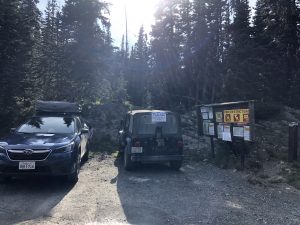
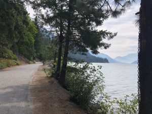
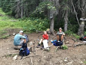
The Halo tramily walked by while I was packing up.   Caught them for some breakfast shortly after.   Spent some time getting to know Dipper.   He’s an interesting character.   Very well read.   We spent our time talking about various economic systems and their merits.   After the trail he plans to finish  building out an old Subaru which he plans to drive down to South America in a few years.   Seems we are of kindred spirit.  
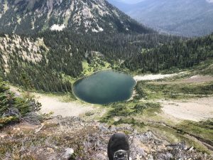
They are planning to camp at Hopkins lake at 2647, then slack-pack down to the border and back.   I like that plan since it was similar to my own.   I know others are trying to setup further back so they do the whole day out and back on an empty pack.  Personally, I feel a little naked being too far away from all my stuff.   I’ve found that Washington has some wild weather swings and I’d hate to get caught in something unexpected.  
Hopkins it is. 
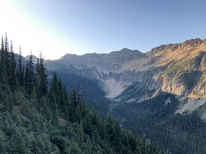
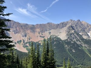
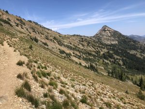
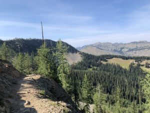
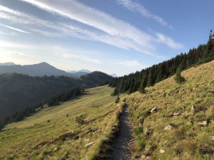
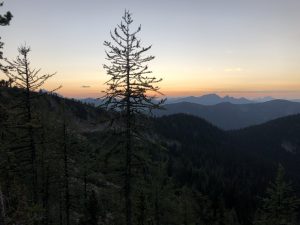
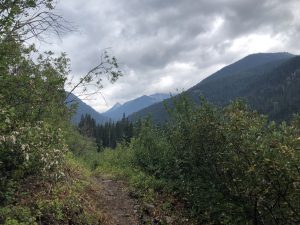
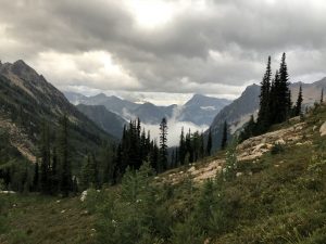
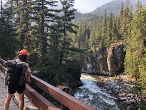
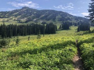
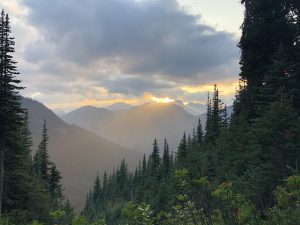
The terrain is beautiful up here. 

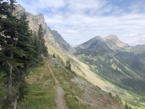
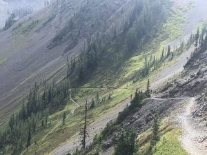
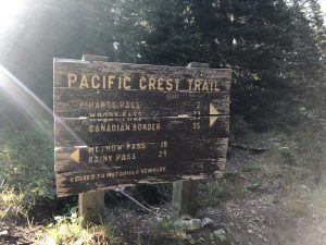
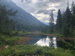
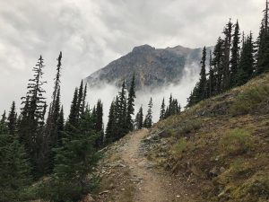
Started bumping into Southbounders who had touched the monument and are headed back to Hart’s pass.  I’d pass them with fist bumps and congratulations.   Everyone is in high spirits.  Halo & co is just ahead of me.  I see them occasionally traversing a pass.   Around 2:00 I catch my first look at Hopkins lake.

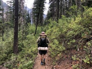
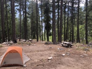
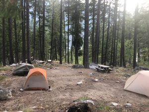
I head down and setup my tent next to a bunch of others.  Empty my pack, toss in my rain jacket, headlamp, and a few other things, then head out for the final stretch to the monument.  Along the way I run into Endless and QB returning from their communion with Canada.   They are pumped.  We give each other hugs and agree to meet sometime in the future.   Love those folks.  
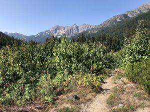
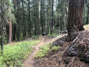
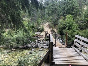
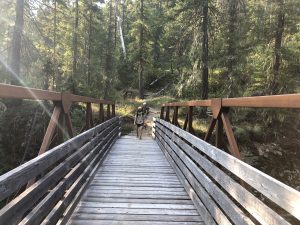
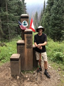
The trail down to the border is kind of an overgrown mess.   That doesn’t slow me down, I’m heading downhill in a slow jog.  Lot of congratulations and fist bumps on the way.   My anticipation is building.   Finally around 4:30, I pop out of the bush and into a small clearing with the monument.   Halo and company are sitting there talking. 
Dipper, Chief, and Halo
I walk over and give the monument a big hug.   I’ve made it.   I snap a few pictures with my tramily friends.  
Dipper Owning It
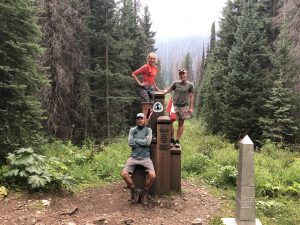
Then light up a cigar I’ve been carrying since Campo and puff away in satisfaction.   Really good cigar.   Before Dipper takes off, he gets a few snaps with me at the Monument.   
Salty J Steps into Canada
Victory !
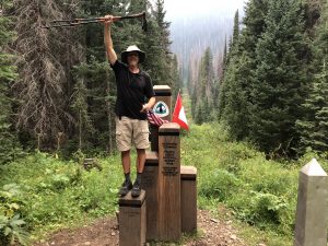
They take off and I sit down, alone to finish my cigar and think a bit.   2,650 miles of hiking over two seasons.   I’ve walked from the Mexican border to Canada through some of the most spectacular, untouched wilderness in the country.   I first got this itch back in 2003 and now it was finally scratched.  I suppose I should be more emotional but that’s the thing about walking 2.5 miles/hour….I’ve already had plenty of time to process all the emotions.   Now I’m just done. 
  
Cigar smoked, log book signed, I picked up my pack and gave the monument one last look then headed back up the trail in the fading light.

     
THE END

8/18 Mile 2600-2431

Woke up shortly after the others left today and headed out into the cool air.  The cloud cover left me this morning and for now it looks like the smoke is all to the south.  First goal is Hart’s Pass, the last road accessible spot on the PCT.  After that I’ll see how much more I’ve left in the tank.

I honestly don’t remember much from today.  The trail was in good shape and generally stayed on the ridges, so I didn’t have to do much descent/ascend cycles.  
Another Salty Approved Stream Crossing

One thing to note is that the area around Harts pass is well known to be a treacherous place in the snow.   I totally get that.  Have a look at this pic
Don’t Slip

A big chunk of this ridge walk is along a narrow, sandy trails on a steep incline.  Occasionally it turns to a rocky one, but equally narrow and even steeper.   While I’m walking, I’m imagining what it would be like in a foot of fresh snow.  Folks often get hit with snow up here in September and have to either wait out the melt or roll the dice on hiking through.  They’ve got my respect. It would be really hard to self-arrest on such a steep slope.      

I make Harts pass at 4:30
Canada is Calling
Burned out Campsites
I carry on to the entrance parking lot and it looks like a junkyard.  
LOL
KIA, Low Mileage
I’ve heard this dirt road is 17 miles long and very sketchy.  There are lots of pot holes and boulders on the road.  No turn outs and single lane most of the way.  Looks like the car blew its tire and the driver just kept going on the rim.  I bet more than just the rim is trashed.  The tow bill is not going to be cheap. 
I carried on to take down the next pass, Buffalo, then took down Foggy pass and finally Jim Pass.  All these passes sound impressive, but basically each one is just a couple 100 feet of elevation.   The trail is being good to me, staying on the ridges.   
Stick to the Ridge !
Yet Another Wilderness Boundary
This Spot will do for the Night

I passed Halo and company a couple miles back.   They were all tented up and bedding down, chatting away.   Finally stopped a little before 9 at a tent site next to Jim Pass.   It was a huge flat spot with lots of wind protection.   I logged my first 30+ mile day!  Git’er Done. 

8/17 Mile 2573- 2600

We got on the shuttle at 8am and it makes a stop at the bakery before heading to the trailhead.  Hikers piled out to buy various pastries for the day.  I grabbed a cold sandwich and something sugary.  I run into Niko again and we catch up a bit.  Haven’t seen him for a couple weeks.
    
Back on the bus, I met a few other hikers for the first time.  A gal named Halo is hiking with her 17 year old daughter Chief.  Dipper, a guy from Denver, is also hiking with them.   Nice tight little tramily (trail family).  Another tramily is composed of a tiny gal Sunrise and two dudes Viking and Wrong Way.   She’s in charge, setting the hiking goals and stops for each day.  The boys nod.    
Interesting I’m running into my first tramilies for this hike.   Must be on the leading edge of the bubble.  While all the hikers are catching up with each other, I head over and talk to the shuttle driver.   He is the opposite of the sort of person I normally run into in this role.  He has no interest in thru-hikers.  I think he considers them sort of a blemish on society, kids (mostly) who don’t work and feel entitled.   Flipping my point of view, I can see where he is coming from.  This is the last stop for most hikers.  They are broke, at their peak hiking fitness, and feel like champions.  This poor guy has to haul their euphoric asses back and forth every day.  He seems bummed that the peak flow is about to arrive like a cloud of locust.
   
The Hiker Drop
Hikers take off in small groups and I finish up my conversation with Sullen Shuttle Guy.  The trail follows a river valley gradually upward from 1500 ft to 6k over a 21 miles stretch.  This is my kind of climb.  I rack my hiking poles and decide to maintain a fast pace and start off.  

I Need a Passing Lane
Around noon I run into this guy
Patches (Rear View)
He got an early ride from SVR and has been grinding uphill.   We hike together for a bit and catch up.   He’s got a friend meeting him at the next pass who is going to give him a resupply and hike with him for the last segment.   We cross over this new bouncy bridge. 

Shortly after that I stop for lunch with Patches around a set of nice boulders.  My cold bakery sandwich turns out to be a disappointment.  It is a giant bun surrounding 3 thin slices of roast beef and a couple sad looking tomato slices.  Guess bread and sugar is all they got.  Dog Bite turns up and joins us.
   
Dog Bite keeps working me on my target for tonight.  I know he wants to hike together to the end, but it really isn’t my style right now.  My goal is to hike until I can’t, nothing more or less.  After lunch, I take off in the lead and turn the burners on, the other two guys slowly drop off behind me. 
 
I’m feeling really good.  I’m rested, motivated, got the music blasting through my earphones.    The weather is cool and getting colder.  Perfect hiking weather.  On the way up I pass both tramilies I met previously plus a number of other rando’s.   I’m smoking everyone today.  

I hit the Rainy Pass trailhead at 2592 and run into Patches friend, Bone Spur eating a bunch of berries.   I stop and chat with him for a bit.  He met Patches a few years ago on the trail in California.  They stayed in touch and now he’s doing a little Angel work.   I told him Patches was about 30 minutes behind me and took off.  
I took a break at the picnic tables to make a little afternoon noodles and talked to Dipper for a bit when he caught up.   They are aiming for a site over the peak at 2600 and I figure that sounds like a good goal.   
The weather continues to get cloudier and colder.   I’m getting hit with little rain showers so I stop to put on my wet weather gear and add layers.  

It is about 8:00 when I go over Cutthroat pass and begin to head down to the campsite.  I get that cool spooky feeling of being alone on a mountain top late in the evening where the temperatures are dropping and the wind is picking up.   There is a timelessness to these places that always sends some shivers down my spine.  
I do the next 2 miles in a hurry and find the Halo Tramily all setup and comfy.  There’s no room at their site, so I put on my headlamp and check some of the others.   I find a good one and put my pack down, getting ready to setup my tent.  Then I remember to look up and scan the trees….there is a big dead tree that has fallen but is hung up in the branches of a neighbor.  Hmm.  I move my pack and walk over to give that dead tree a push.   It comes crashing down right where I would have put my tent.   Strike that site off the list.
 
I finally head back to where the tramily is and find a flat spot right next to the trail.  That will have to do.  I’m finally in bed by 10:00.   I’ve logged a good day. 

8/16 Zero’d

 
Dog Bite and I grabbed the shuttle and hit the bakery again in the morning.  Last night his mother and brother showed up to wish him happy birthday.   He seems really happy. 
 We talk a little bit about retirement.  He is was a school principal on some island off the Washington coast.   I think he misses it.   Now he splits his time between Washington and Palm Springs where his mother lives.   Like me, he is finishing up the trail.   He started in 2016 and had to get off in Oregon due to an injury.   After breakfast we split up on the walk back.   He wants to take pictures and, well, I’ve been there / done that. 
  
I hit the post office following a long ling of hikers in.  My man, McGriddle is there.   We last saw each other at Steven’s pass when he jumped in the ride that had dropped me off from town.  I finally get the McGriddle story.   Apparently back in Southern California, he ordered a McGriddle at the McDonald’s stop at hwy 15.   The place is kind of a PCTer landmark because you hit it at mile 341 when the hiker hunger is starting to come on pretty strong.   There’s a reference to the place in my 2017 entry

Day 23 – McDonald’s | Adventure Blog (baumingaround.com)

Anyway, he can’t stop raving about it, so they suggest he try to hike the next 23 miles to Wrightwood solely on a diet of McGriddles.   He buys 15 of the things and pulls it off.  He says he will never eat another one again, heh. 

Endless and QB are sorting through their boxes and will be leaving on the 3:00 shuttle with most of the others.   I somehow miss saying goodbye.   That is the way things go.  As for me, I’m staying in town for another day to eat and give my feet a break.   When I hit the trail tomorrow, I’m burning full speed for the border.   I heard Patches is over at Sehekin Valley Ranch getting fattened up.   Dog Bite, Patches and me will probably hit the trail together on the 9am bus.  
I head back to a lonely night in the PCT camp
After the Hikers Evaporate, All that’s Left is the Salt

8/15 Mile 2568-2573

Got up at 5 AM this morning when I heard Endless and QB rustling.   We don’t have much mileage today, so I lounge in my tent for 30 minutes making some coffee and oatmeal.  I get packed up at 6 and we all leave together.  
Last Night’s Campsite
Virtually all PCT hikers use the GutHook app to navigate the trail.  One of the neat features in the app is the ability to put comments in at various waypoints like streams and tent sites.  Useful things like “Nice flat spot to the left of trail” or “seasonal stream is flowing well”.  Well in my boredom over the last 6 weeks I have been rating every tent site a score of 1 to 10 based on the quality of my stay.  I call it the Salty Scale, a scientifically precise methodology encompassing all the important factors in rating your stay.   
 
While we are walking, QB mentions that there was another of those Washington style pit toilets outside our camp.   I explain the Salty scale to her and she agrees to be a guest rater.  She feels that since the camp was next to a nice creek and the shitter had a nice private view of the water.   After I probe with a few other questions, she assigns the site a Salty 7.   
      
Couple hours of easy hiking and we hit the so called “High Bridge” over the Agnes.   
Endless and QB

Just over the bridge is the shuttle stop and ranger station.  Stehekin is a weird place.  Look it up on a map sometime.   Stehekin is on the north end of lake Chelan, a 60 mile long natural lake that ends at a small town called Chelan on the southeastern tip.  Stehekin is in the middle of a National Recreational area.   The only way in is either a 4 hour ferry ride or walking in on a trail.   There are a bunch of vacation homes here and the community has a small school. 
 
There is a host at the Ranger station to answer our questions.   Only problem is, he doesn’t have many answers.   I ask about Stehekin Valley Ranch and their legendary cabins and 3 meals a day.  He’s never eaten there.  Someone else asks about the produce farm, he doesn’t know much about that either.  Seems our host only knows about places that are government owned and operated.  
Anyway, the shuttle shows up on time and drops a stream of fresh smelling day hikers.  We are greeted by a grumpy bus driver and climb aboard with 5 or 6 other PCTers.   We drive over a bumpy dirt road for 10 miles, then get on (the only) paved road and stop at the bakery.   This place is privately run and serves a cornucopia of Danishes, pies, croissants, cinnamon rolls, and the like.   Endless, QB, and I enter a feeding frenzy.  I buy a ham and cheese, croissant, a Danish, OJ, and large latte.  Endless and QB load up as well.  Endless is laughing that he froze up at the counter and couldn’t order.  Too many options. 

We skip the bus ride to town and instead just walk the remaining 2 miles.   Nice to stroll along the lake shore.    
Last Call for Gumballs

About a half-mile before town we see this cool little wooden boat.  Endless is into sailing and bought a wooden one long ago to restore, but never got around to it.   His brother is a sailor and lives on some island off the coast of Maine (I think).   Anyway, Endless is interested and he stops to take a swim.   Me, not interested.   The water is cold.  I carry on to walk into town. 

After a few inquiries, I find the PCT camp site on top of the hill and head there.   Along the way I bask in the glory of a brand new, government issued bathroom at the welcome center.  It is, well, wonderful.  When I finally get to the camp site, Endless and QB are there setting up.   I put my tent up and head back to village to grab second breakfast/lunch.  While I’m there a ferry pulls up and off-loads a 100 visitors.  Seems there are 2 or 3 which are doing runs all day.  
I talk to a few locals and get a flavor for the Stehekin story. 
Living in the West, I know places like this have a colored history.   Usually it starts with homesteaders taking up residence, killing a bunch of Native Americans, and scratching out a living.   It usually ends with the government taking over all the unclaimed land then squeezing out the homesteaders one way or another.   
Stehekin is in the middle of squeezing phase.  When a home comes up for sale, the gov buys it and either turns it into a cabin rental or tears it down.  Of course, being the government, the cabins retain their “historic nature” which means they slowly decay under coats of “Forest Service Brown” paint.  The gov owned store sucks, the gov owned restaurant serves generic  over-priced burgers, and some of the empty ex-commercial buildings are slowly decaying into “historic” structures.   
Anyway, the place is beautiful, I hear the fishing is good, and I’d definitely put it on my list of places to return to some day. 
 
More hikers come in and begin filling up the PCTer site.  Couple of young gals I crossed on the trail show up and we get to know each other.  Bugeye and Short Stop.  They are doing Washington northbound, so almost done.   Bugeye is a teacher in Seattle, Short Stop is an Alaskan nurse who grew up on fishing boats.   Dog Bite shows up and reminds everyone his birthday is tomorrow.  
In the evening we all sit around and talk about completing the hike.  What does it mean?   What is everyone doing next?  How to rejoin mainstream society.   Interesting stuff, but like hiking, the answers must come from within.   The circle of folks is next to my tent and keeps expanding as darkness falls.  I lay down and keep the doors opened listening to the steady trickle of funny stories, side conversations, jokes, etc.  Today is Sunday.  Tomorrow the Post Office will open, folks will resupply, and take off.   This is the last time I’ll be in a thru-hiker circle like this.  I just want to savor it.  I slowly drift off to the sound of laughter.