Category Archives: PCT

7/22 Mile 2147 – 2167


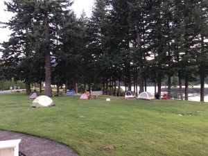
Here is a pic of the lawn I was sleeping on last night at Cascade Locks.

Now, you might think this looks like an ideal location. Nice grassy area, next to the Columbia River, plenty of space between tents, etc. Well the one downside is that the train tracks are about 100 feet away and these tracks are special. These are the super highway of train tracks, with heavily loaded freight trains passing by every 20-30 minutes….all night long. Last one I recall passed by at 1:23 AM before I finally went to sleep. My night on the railroad cost me an early start, I finally got moving around 8:30.

Most of the folks I camped with last night have already taken off. One couple, Work Horse and Chai, who I got to know yesterday have already left. I expect to see them in the coming days. They are in their early 50’s and look like they do my kind of pace.

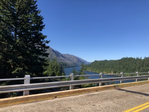
Bridge of the Gods. What a name for this utilitarian, narrow, steel girder bridge. Whoever named this thing was a branding genius. It is a narrow two lane road across with no pedestrian walk way, so I just walked in the road with cars finding their own way around me. Took one quick pic while I was walking across.
The unGodlike 2 lane Bridge

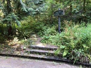
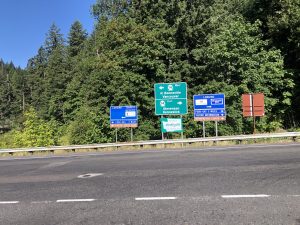
PCT Gets its Own Road Sign

Got on the trail and started climbing. Wow what a difference. I’m walking through an old-growth forest. I counted the gowth rings on a couple trees that had fallen over the trail and had been sawed in half. These beasts are over 150 years old. An added bonus was ZERO bugs. So it was a groovy shady climb out of the river valley filled with black berries I’d pick as I ascended.
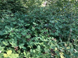
Yum !

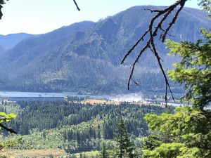
Looking back at the Cascade Locks and the Hydroelectric dam

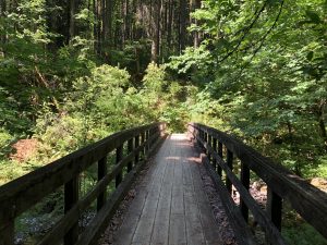
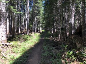
Huge difference in the trail here. The trail is wide, well maintained, and all the fallen trees have been cleared. The footing is nice and soft. Loved it.
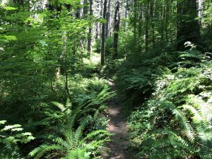
Nice Trail

I’m starting to run into more Southbounders (SOBO’s). These folks have already done 500 or so miles and are getting their trail legs, so I didn’t talk to them much. They are trying to get the miles in and since we are passing each other, what’s the point in long conversation? While I don’t get to speak with many folks, there are plenty of snakes to hang  with.
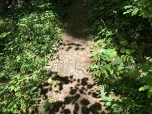
Snake !!

When I got to the top of one of the climbs, there are the ruins of an old railway siding structure that was destroyed in a 1929 fire. Pretty much just a pile of wood and steel cables now.
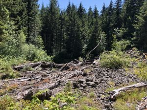
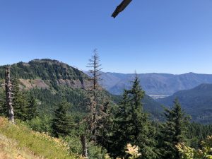
Siding Needs a Little Work
Last View of Cascade Locks

Once I gained some altitude, around 3k or so, the trail alternates between shady forest and stretches of open areas filled with tons of plants with supercharged growth. It feels like I’m in a salad.
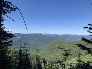
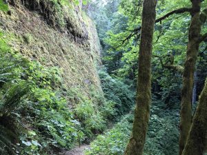
Salad Bowl

So Long, Mt Hood
Fuzzy Forest

Around 6 O’clock, I hit the creek that I was targeting to camp only to find tents all over the place. Work Horse and Chai were at one nice spot next to the creek. Next was a local backpacker who absorbed a 3 tent site with his one tent and yard sale of camping stuff (camp chair, hamock, etc). The next spot had 3 ladies in 2 tents squished together.

My next alternate was occupied by Papa and John, two cousins about my age who are sectioning some of Oregon and all of Washington. Papa John, get it? Anyway, they looked comfortable in their nice spot with no room for the Salty One. I resigned myself to doing another mile or two.

The next potential spot was off trail along a dirt road. It was getting dark and I didn’t really want to be night hiking. There was some chatter about camping spots 5 minutes south of the trail, so I gave that a shot. The good news was I found it. The bad news was there was a truck parked there with an older women and 2 barking dogs that came running at me all snarling. Talking, well shouting actually, she offers to let me stay there. She says her dogs are “Trained Service Dogs”. Apparently they are trained to ignore her. Yeah….no thanks.

Saw some dirt roads leading off the main road and kept looking. Eventually I found an awesome spot right next to the river. Huge, flat, and unoccupied. As I was setting up, I could hear the lady’s dogs barking at another hiker who was in the same predicament. Then another. Poor folks probably had a crappy night.
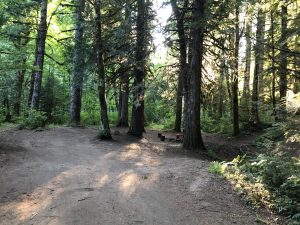
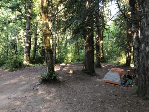
I’ll Take It
Taken

7/21 Miles Alternate Route (about 10 miles) – 2147


I bounced out of the tent at 6 this morning was on the trail before 7. I was pretty charged up this morning because this was going to be a very scenic part of the trail as I followed Eagle Creek down to the Columbia.

Here is the evidence.

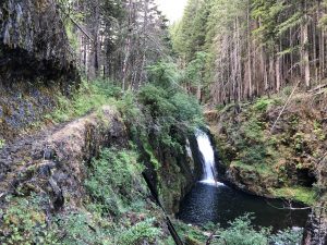
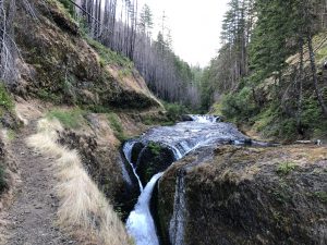
Falls Just Below the Campsite

Falls

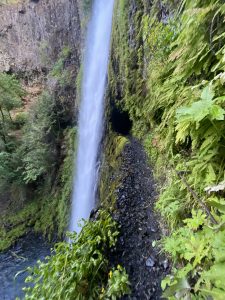
After a couple miles, Pancakes and her dog caught up with me just in time for the highlight of this stretch. There is this big water fall feeding inth Eagle and the park service has blown a tunnel into the rock behind it to pass through.

Tunnel Passage

I took a video of the passing through and she took one of me. Here they are:

Pancakes and Super Tramp

Salty J making his passage

As I walked Through

Following that transit, I took off ahead of Pancakes. Didn’t see much of her for the rest of the day, but I did have plenty of company. Dozens and dozens of day hikers coming up the trail. I’m so glad this was Wednesday. I bet this place is a mad house on the weekends.

Cool Pool

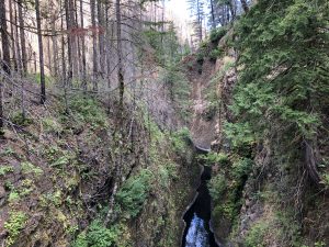
Popping out of the trail, I followed the road down, then hit a stetchy looking Gorge Trail which dropped me on the old highway route which has been converted into a walking area. It follows the river up to the Cascade Locks and the Bridge of the Gods which winds up the Oregon segment of the trail.

Hike Me

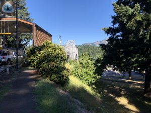
There is a small state park campsite next to the river on the land that used to be occupied by the folks who ran the old locks before the dam was built. The good people of Oregon let the PCTer camp on the lawn next to the administration building.

I’ve spent most of the day cleaning up and provisioning for the next leg. This is going to be a long one of about 150 miles. I expect I’ll be in the woods for 6 or 7 days, so I’m going to be carrying a pretty heavy pack. Next stop, the Kracker Barrel general store at 2295.

7/20 Mile 2112 – 2128 + 5 on Alternate

Decisions. This morning before I packed up, I was still not sure if I was going to take the alternate at 2128 or just follow the PCT. The PCT route stays high and looks kind of samo-samo. The Alternate, on the other hand, drops into the river valley of Eagle Creek which looks to have some cool waterfalls. I made a plan for both routes.

I figured that either route was going to be an easy day since it was looking like the next campsite would be about 20 miles downhill from where I started. Lingered around my tent until 8 making some extra breakfast, chatting with passerby backpackers, and generally getting a lazy start.

Man was I wrong.

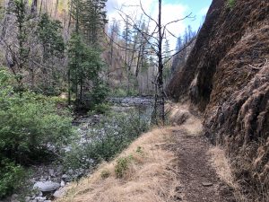
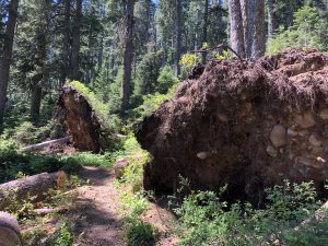
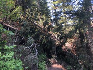
You’d think the trail would something like this

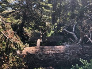
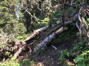
But what it actually was, looked more like this

Upended

This went on for hours. There were fresh fallen trees everywhere and these were not the easy hop over and keep going variety. No, these were the climb/crawl variety, contorting my body to fit through the gaps. Sometimes, the gap was too small, so I’d unsling my pack and throw it over/under the obstacle before moving on to the next one a 100 yards down the trail. It was exhausting and a little scary sometimes. Nothing like climbing over a shifting tree while hanging above a steep drop-off.

While enjoying today’s gymnastics I ran into a few day hikers and backpackers sharing their tales. Got passed by a few PCT’ers in the afternoon, Guy named Bloodbeard and a gal named Rocket. They convinced me that the alternate route was worth the diversion, so that settled my decision.

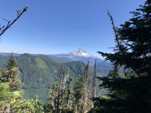
Last I’ll see of Mt Hood today
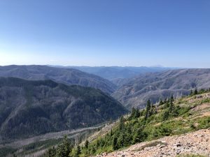
Next Stop is Down There Somewhere

At Eagle Creek Trail Junction, I found my two PCT friends at a picnic table chatting. Rocket had her pack on and looked ready to go. Bloodbeard, on the other hand, was seated and looking very pleased with himself drinking a can of Pinot Noir. Yes, a 12 oz pop-top of Pinot. It’s an Oregon thing, they told me.

So the first 2 miles of this “trail” is really just a ratty, unmaintained foot path that goes straight downhill. I looked at the topo and it is simply a straight line perpendicular to lines of elevation. No switchbacks, lots of blowdown trees to crawl over, and, in some cases, no trail either. The drop was from 4,200 feet to 1,800 over about 1.5 miles. It seemed Rocket was waiting for someone to go first and it certainly wasn’t Bloodbeard, given his half full Pinot, so I dived in.

Rocket followed and BloodBeard caught up to us on the way down. They let me lead, picking my way down the mountain. When we lost the trail, one or both would make some suggestions from above and behind me. As promised it was straight down. It would take me all day to climb back up which I guarantee I’ll never do. The funny thing was that it eventually dump me stumbling onto a properly maintained trail. You really begin to appreciate the work that goes into trail construction and maintenance after an experience like this.

So on the maintained trail I stayed in the lead and hit the first water spot to refill. I had been dry for a couple of hours. As I was topping up, I saw Rocket eating a mouthful of blackberries. That pretty much slowed my pace to a crawl, as I was scooping them up by the handful by the trail. Those two took off and I didn’t see them again.

Got passed by another Gal named Pancakes who was hiking with her dog “Super Tramp”. The dog looked like a golden retriever, but she called him something else. Said he used to guard castles in the old days. Anyway, the dog was caked with mud and humping his own dog pack. He seemed pretty happy. Said they had done like 29 miles that day.

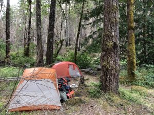
Got to the tent site about 5 miles into the alternate. It was a fantastic spot right next to the river and just above the first set of falls. Pancakes was already getting her tent up and making dinner. Another older gal was also there all settled in. She told me this was her first backpacking trip….ever. Well, I wasn’t going to take no for an answer so, I just dropped my pack and started setting up my tent next to her. Later that night, another PCT’er showed up and plopped down next to both of us. Guess she is getting a little more than she expected on her first backpacking trip 🙂

I fell asleep to the sound of the falls.

7/19 2097-2112

Up at 5am, showered, then jumped on the Oregon Breeze bus and did the 2.5 hour ride to Government Camp. I asked the bus dude if he’d drop me early at Frog Lake, but that was a no-go. Hey, he just drives the bus man.

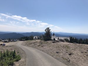
After that drop off, I got some breakfast at a local restaurant then waited another 2 hours for the shuttle that takes me uphill to Timberline Lodge. Got there at 12 and packed my resupply box.  There is supposed to be an amazing buffet here, but time’s awasting. Got on the trail at 1.

As a little side note, I think Timberline was the location where the Shining was shot back in the day. I was in a hurry and did not get a frontal shot of the place.

Bye Timberline

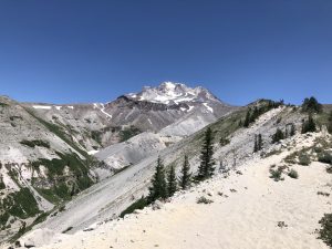
Only thing I knew to expect today was that I’d be doing a lot of downhill. The trail picks up at 6k on the side of Mount Hood, then follows the western side going up and down through gorges. Ton of day hikers out here today. Passed a few overnight backpackers on various climbs today. Surprised how fast I’m moving now.

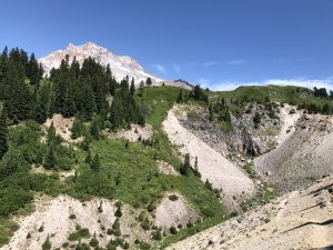
Mt Hood

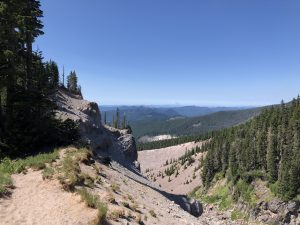
I did a little figuring when I was coming down. This picture shows where I end up at the bottom of the big downhill. If you look at that second escarpment at the center, that was where I eventually ended up near Ramona falls.

A little farther downhill

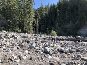
When I got to the river valley and climbed over a bunch of blowdowns, the next biggie was the Sandy river crossing. I ran into a couple trail crew folks, one of whom pointed me to a ford point. She says “Shouldn’t be too deep” so I just jumped in and started wading. It wasn’t bad, except the last bit where the water got up to my crotch. The flow was really strong here, but I polled my way through it and got to the other side. Took a quick picture of some other folks crossing behind me. On hindsight, should have taken a better one.

The Crossing

After that it was more down to the tentsites at Ramona falls. There must be an easy access from a nearby trail head, because all the sites had at leat one person in it with a pile of car camping type gear. Saw kids porting in all kinds of stuff like folding chairs, big bottles of propane, and one kid with a coleman camp stove. Looks like quite a party was getting provisioned.

There was still some light left and I wanted to get the next climb out of the way. So back up from 3k to around 4.5k. Made the camp site by 7, but unfortunately someone(s) beat me to it. There are some huge blowdowns in this area which is in a saddle at the top of the ridge. Most of the other sites were wrecked. Had to put another 30 minutes into brush clearing and got a flat spot to setup. Did a 15 miles on a half day. Pretty happy with that.

7/18 Zero’d

Spent most of the day doing laundry and fixing stuff. My hose and bladder system is an endless source of frustration. I have to rethink that setup someday. The Salty hat has received a new fix in the form of a sock cut to the right lenght and taped inside. I want this hat to make it to Canada in some form.

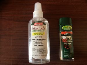
I finally found some proper DEET. Bought two bottles. The Botanical’s are going into the trash. So happy to be stocked with some real chemical vengeance !

Bringing the Pain

The hiker hunger has definitely kicked in. I’m eating everything in sight!. Getting a bus ride back to the trail on Tuesday. Should be restarting around 2097.

Meanwhile, Stormtrooper has been texting me. He will arrive at Shelter cove tomorrow (1906). That kid is going to catch me soon.